Appraisal
North America Map 1763 Appraisal
Get AI-powered appraisal estimates for your North America Map 1763. Upload a photo for instant valuation.
Recent north america map 1763 appraisals
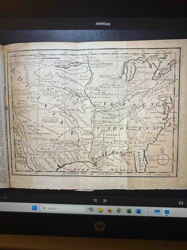
Historical Map
1763 Map of a Portion of North America from Gentlemen's Magazine
Antique Maps and Cartography
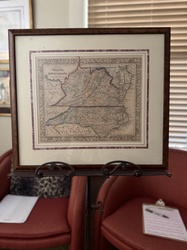
Samuel Augustus Mitchell 'County Map of Virginia and North Carolina' (c. 1860-1867)
Antique Maps and Prints
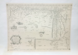
Antique Copperplate Engraved Map of North Africa (Cyrenaica, Marmarica, and Libya Exterior)
Antique Maps and Cartography
Ptolemaic Map of North Africa (Tabula Aphricae II)
Antique Maps and Cartography
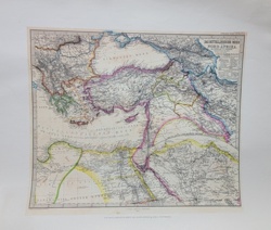
Stieler's Hand-Atlas Map: Das Mittelländische Meer und Nord-Afrika
Antique Prints & Natural History Illustration
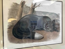
John James Audubon, The Viviparous Quadrupeds of North America, Plate CXVI: Black American Fox
Framed Art Print
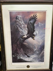
Limited Edition Print 'Spirit of the North' by Ted Blaylock
Archaeological Artifacts / North American Lithics
Prehistoric Lithic Scraper / Bifacial Tool
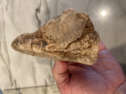
Prehistoric Artifacts / Indigenous North American Antiquities
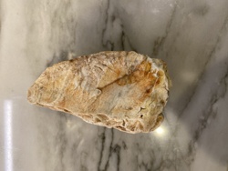
Paleo-Indian Chert Effigy Hand Tool
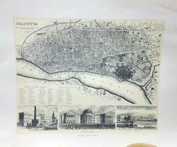
Antique Map Reproductions / Cartography
Antiquarian Map of Calcutta and the Hoogly River
Historical Map
1763 Map of a Portion of North America from Gentlemen's Magazine
Antique Maps and Cartography
Samuel Augustus Mitchell 'County Map of Virginia and North Carolina' (c. 1860-1867)
Antique Maps and Prints
Antique Copperplate Engraved Map of North Africa (Cyrenaica, Marmarica, and Libya Exterior)
Antique Maps and Cartography
Ptolemaic Map of North Africa (Tabula Aphricae II)
Antique Maps and Cartography
Stieler's Hand-Atlas Map: Das Mittelländische Meer und Nord-Afrika
Antique Prints & Natural History Illustration
John James Audubon, The Viviparous Quadrupeds of North America, Plate CXVI: Black American Fox
Framed Art Print
Limited Edition Print 'Spirit of the North' by Ted Blaylock
Archaeological Artifacts / North American Lithics
Prehistoric Lithic Scraper / Bifacial Tool
Prehistoric Artifacts / Indigenous North American Antiquities
Paleo-Indian Chert Effigy Hand Tool
Antique Map Reproductions / Cartography
Antiquarian Map of Calcutta and the Hoogly River

Antique Cartography and Printed Maps
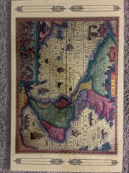
A New & Accurate Map of North America (c. 1790s)
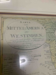
Antique Map
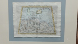
Karte von Mittel-America oder Westindien (Map of Central America or West Indies)
Art and Collectibles - Cartography / Wall Decor
Framed Reproductions of Visscher and Hondius Maps of America
Art & Collectibles
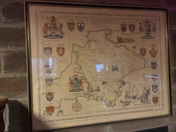
Framed Pictorial Map of County Durham
Decorative Art / Map Reproduction
Reproduction Antique Map of The Americas
Vintage Map
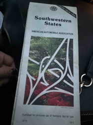
AAA Southwestern States Road Map
Political Memorabilia & Collectibles
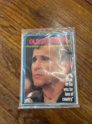
Oliver North - Portrait of an American Hero: Special Collector’s Edition Magazine
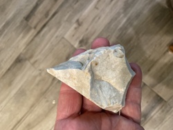
Prehistoric Artifacts / Indigenous North American Lithics
Prehistoric Lithic Core Scraper Tool
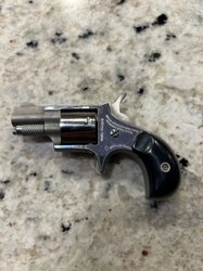
Firearms
Miniature single-action revolver bearing North American Arms markings

Apparel & Accessories
The North Face Fleece Jacket (Dark Gray/Black)
Antique Cartography and Printed Maps
A New & Accurate Map of North America (c. 1790s)
Antique Map
Karte von Mittel-America oder Westindien (Map of Central America or West Indies)
Art and Collectibles - Cartography / Wall Decor
Framed Reproductions of Visscher and Hondius Maps of America
Art & Collectibles
Framed Pictorial Map of County Durham
Decorative Art / Map Reproduction
Reproduction Antique Map of The Americas
Vintage Map
AAA Southwestern States Road Map
Political Memorabilia & Collectibles
Oliver North - Portrait of an American Hero: Special Collector’s Edition Magazine
Prehistoric Artifacts / Indigenous North American Lithics
Prehistoric Lithic Core Scraper Tool
Firearms
Miniature single-action revolver bearing North American Arms markings
Apparel & Accessories
The North Face Fleece Jacket (Dark Gray/Black)
Process
How our AI north america map 1763 appraisal works
- 01
Upload your photo
Take a clear photo of your north america map 1763 and upload it. One photo is all you need.
- 02
AI analysis
Our advanced AI technology analyzes your item.
- 03
Receive estimate
Get a detailed appraisal report with estimated value range, market insights, and item details.
Get the best appraisal
For the best results
- Use good lighting to capture all details
- Place item on a neutral background
- Include any identifying marks or labels
- Ensure the entire item is visible in frame
Ready to appraise your north america map 1763?
Get your free AI-powered appraisal in under 60 seconds
No registration required · Free to use · Instant results