AI Item Analysis
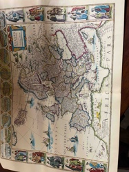
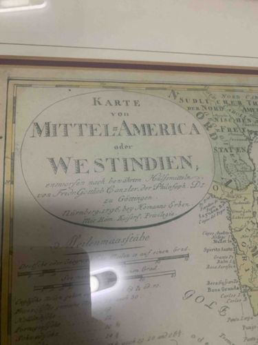
This item is an antique framed map, specifically titled 'Karte von Mittel-America oder Westindien' (Map of Central America or West Indies). The map originates from 'Nürnberg, bey Komanns Erben' (Nuremberg, by Komann's Heirs) and was 'entworfen nach bewährten Hülfsmitteln' (designed according to proven auxiliaries) by 'Frede. Gotteb. Ganzler. der Philosoph. Dr. zu Göttingen.' The title is prominently displayed within an oval cartouche located in the upper-left quadrant of the map. Visible details include delicate hand-drawn lines indicating geographical features and border areas. The color palette appears to be muted, featuring light yellows and greens characteristic of aged paper and hand-coloring techniques. The paper itself shows signs of age, including potential discoloration or foxing, though the overall condition appears to be well-preserved within a frame. A distinct 'Meilenmaasstäbe' (mile scale) is present below the title cartouche, indicating various measurement scales such as 'Deutsche oder Geograph.' and 'Grad'. The map depicts a portion of North America, Central America, and the Caribbean islands, with discernible labels such as 'SÜDLICHER THEIL VON NORD AMERICA' (Southern Part of North America) and 'STATES' (likely referring to the United States). Coastal outlines and some internal political divisions are visible. The craftsmanship suggests a high level of detail and precision typical of 18th or early 19th-century cartography. The framing, with visible cream-colored matting and a dark wood or similar material outer frame, suggests it has been protected and displayed as a collectible artwork. There's a notable glare or reflection from a light source in the lower-left section, obscuring some details in that area.