Photo and notes provided by the user — not generated by AI
Submitted photo · July 21, 2026
User's notes
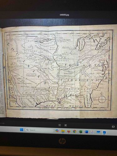
GENTLEMAN’S MAGAZINE, London, June 1763 - 1763 map of a portion of North America - Slave insurrection in the West Indies. Prime feature of the issue is the foldout map which shows the greater portion of the American colonies.
AI analysis below
AI appraisal
AI analysis & estimate
AI-Generated · Verify before acting
Everything below is generated by AI for informational purposes only. AI can make mistakes — the AI may misidentify items or misattribute them (artist, maker, brand, designer, origin, era). This is not an official valuation and should not be used for insurance, sale, tax, estate, legal, or lending purposes — or any decision requiring a certified appraisal. It is not an authoritative claim about any person, brand, or rights holder — do not share or rely on it as a factual statement about a third party. Always consult qualified professionals before making financial decisions.
Note
This analysis also relies on unverified notes provided by the user, which may be incomplete or inaccurate and could affect the result.
This is an antique fold-out map of a portion of North America, specifically dating to 1763 based on the provided context. The map is printed on what appears to be aged paper, exhibiting a light cream or off-white color that has likely browned with age, suggesting a natural patina. It displays fine line engraving, characteristic of 18th-century cartography, with clear rivers, geographical features, and political boundaries labeled. Visible colonial names include 'Virginia,' 'Carolina,' 'Georgia,' and 'Florida,' along with the 'Gulf of Mexico.' The map appears to be well-preserved for its age, though slight creases or folds are evident, which is common for a fold-out map. The overall condition seems good with no obvious major tears, significant staining, or foxing discernible from the image, but a more direct inspection would be needed to confirm. The edges of the paper appear relatively clean, though the left side is bound into what looks like a publication's spine. The craftsmanship appears to be of high quality, indicative of professional mapmaking during the period. The absence of color suggests it was an uncolored issue, intended for basic geographical reference rather than decorative display.
AI Appraisal Report
·AI can make mistakes·Verify before acting
Upon examining the provided image of the 1763 map from Gentleman's Magazine, I observe a well-preserved antique fold-out map of North America. The paper exhibits characteristics consistent with 18th-century aging, displaying a light cream tone. The fine line engraving is clear, detailing rivers, geographical features, and colonial boundaries like 'Virginia' and 'Florida,' typical of cartography from this period. For a fold-out map of this age, the condition appears remarkably good; while slight creases are evident, there are no immediate signs of major tears, significant staining, or foxing. The uncolored appearance is normal for an issue intended for reference rather than decorative display.
My assessment of authenticity, based solely on visual examination, suggests this is a genuine 1763 map from Gentleman’s Magazine. The cartographic style, paper aging, and binding appearance align with known examples from that publication and era. The mention of ‘Slave insurrection in the West Indies’ and the map being a ‘prime feature’ within the June 1763 issue further supports its historical context and likely authenticity.
In terms of market conditions, 18th-century maps, especially those detailing significant periods like the American colonial era, maintain steady demand. Items from Gentleman's Magazine are generally well-documented and sought after by collectors of historical documents and maps. The rarity of uncolored issues in such good condition contributes to its value. Factors positively impacting value include its age, historical significance to North American colonial history, and its relatively strong condition for a printed item of this vintage.
However, there are limitations to my authenticity verification from images alone. A definitive authentication would require a physical inspection to assess paper quality (e.g., chain lines, watermarks), printing methods, and any repairs not visible in the image. Provenance documentation, such as records of prior ownership, would also bolster authenticity. Scientific testing, like paper fiber analysis or ink composition analysis, could provide irrefutable proof but is typically reserved for higher-value or contested items.