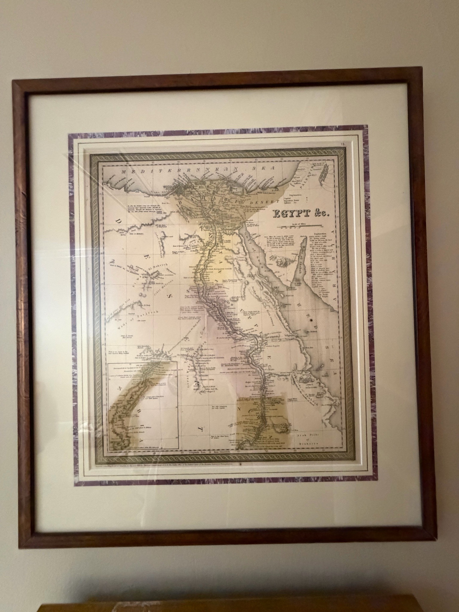
Samuel Augustus Mitchell Antique Framed Map of Egypt
This is a 19th-century hand-colored engraved map showing Egypt and parts of the surrounding region, commonly identified as a Samuel Augustus Mitchell production such as 'Egypt &c.' from Mitchell's New General Atlas. The map is housed in a contemporary wooden frame with a double mat, featuring a decorative purple patterned inner border. The map itself is printed on paper and utilizes fine line engraving to depict the Nile River, Red Sea, and topography. It features classic Victorian-era cartographic elements, including a scale of miles, detailed explanatory text in the margins regarding geographical terms, and a characteristic decorative grape-vine or floral steel-engraved border. The colors consist of faded yellow pigments highlighting political or natural boundaries. Notable condition issues include visible creasing and undulation in the paper, particularly a large horizontal fold across the top and vertical buckling, along with significant foxing and uneven browning (toning) near the bottom right and center. These signs of aging suggest the paper has been acidic over time or exposed to humidity. The craftsmanship is indicative of mid-to-late 19th-century American commercial cartography, specifically the Philadelphia style popularized by the Mitchell firm during the 1860s-1880s.
AI-Generated Appraisal Disclaimer
Estimated Value
$150-$250
Basic Information
Category
Cartography & Antiquarian Maps
Appraised On
May 7, 2026
Estimated Value
$150-$250
Item Description
This is a 19th-century hand-colored engraved map showing Egypt and parts of the surrounding region, commonly identified as a Samuel Augustus Mitchell production such as 'Egypt &c.' from Mitchell's New General Atlas. The map is housed in a contemporary wooden frame with a double mat, featuring a decorative purple patterned inner border. The map itself is printed on paper and utilizes fine line engraving to depict the Nile River, Red Sea, and topography. It features classic Victorian-era cartographic elements, including a scale of miles, detailed explanatory text in the margins regarding geographical terms, and a characteristic decorative grape-vine or floral steel-engraved border. The colors consist of faded yellow pigments highlighting political or natural boundaries. Notable condition issues include visible creasing and undulation in the paper, particularly a large horizontal fold across the top and vertical buckling, along with significant foxing and uneven browning (toning) near the bottom right and center. These signs of aging suggest the paper has been acidic over time or exposed to humidity. The craftsmanship is indicative of mid-to-late 19th-century American commercial cartography, specifically the Philadelphia style popularized by the Mitchell firm during the 1860s-1880s.
Get Your Items Appraised
Instant estimates of your treasures with AI-powered instant appraisals