AI Item Analysis
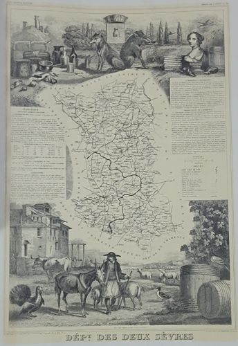
This is a detailed mid-19th-century engraved map of the French department of Deux-Sèvres, likely originating from Victor Levasseur's 'Atlas National Illustré des 86 Départements et des Possessions de la France.' The piece is a black and white engraving on paper, featuring a central geographical map defined by its administrative boundaries and topography, surrounded by elaborate allegorical and descriptive vignettes. The top section showcases a wolf and a wild boar flanking a coat of arms, alongside still-life elements and a portrait bust. The bottom section depicts a pastoral scene with a farmer, livestock including cows, a donkey, and sheep, as well as wine barrels and local architecture. Extensive text panels flanking the map provide historical, statistical, and administrative data of the region. The engraving demonstrates high-level craftsmanship characteristic of 1840s-1850s French steel engraving, with fine line work and cross-hatching to create depth. Condition appears generally good with minor age-related toning (patina) and slight waviness in the paper, which is typical for antique prints of this period. There are visible margins, though the very bottom edge shows some slight cropping or wear near the title 'DÉPT DES DEUX SÈVRES'.