AI Item Analysis
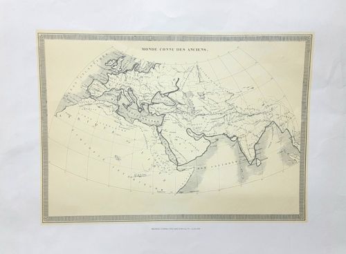
This item is an antique-style monochrome map entitled 'Monde Connu Des Anciens' (World Known to the Ancients), likely produced in France during the mid-to-late 19th century. The map is printed on cream-colored paper with a horizontal orientation, encased in a simple rectangular border featuring a classic fluted or 'piano key' pattern. It depicts a hemispherical projection of the Eastern Hemisphere as understood by ancient civilizations, covering Europe, North Africa, and parts of Asia including India and the Arabian Peninsula. The cartography utilizes fine line engraving, with shaded coastlines and topographical details indicating mountain ranges and major river systems. Text is in French, with notable labels such as 'OCEAN ATLANTIQUE' and 'MER DES INDES'. The paper shows significant signs of age-related wear, including prominent vertical and diagonal creasing, light foxing, and a natural yellowing or patina consistent with its estimated age. There is no visible evidence of modern chemical bleaching. The craftsmanship is indicative of high-quality lithography or steel-plate engraving from a historical atlas or educational text. Small text located at the bottom center likely credits the original engraver or publisher, further reinforcing its status as a 19th-century educational print.