AI Item Analysis
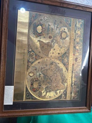
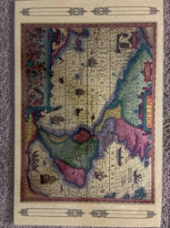
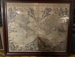
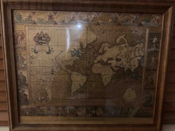
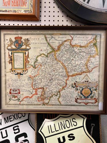
This item is a framed reproduction of Christopher Saxton's historic 1576 map of Warwickshire and Leicestershire. The piece is printed on what appears to be a textured, aged paper stock, mimicking the vellum or parchment used in 16th-century cartography. Physically, the map measures approximately 16x20 inches and is housed in a modern, dark brown wooden frame with a gold-tone inner fillet. The color palette features a desaturated cream background with hand-colored accents in vibrant red, green, and gold across the cartouches and county borders. A notable feature is the large Royal Coat of Arms of Queen Elizabeth I in the upper left corner, balanced by an elaborate cartouche and distance scale in the lower right. The map includes decorative flourishes such as script lettering for neighboring shires (e.g., 'Parte of Stafforde Shire'). In terms of condition, there is prominent foxing and yellowing, particularly towards the right-hand side, though these may be printed-on 'antique' effects typical of mid-20th-century reproductions. The paper shows slight undulation behind the glass. The presence of a modern caption line at the bottom center identifying it as 'Saxton's Map of Warwickshire and Leicestershire 1576' confirms it as an educational or decorative facsimile rather than a period original. The craftsmanship is decent for a souvenir-grade print, suitable for traditional decor.