AI Item Analysis
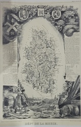
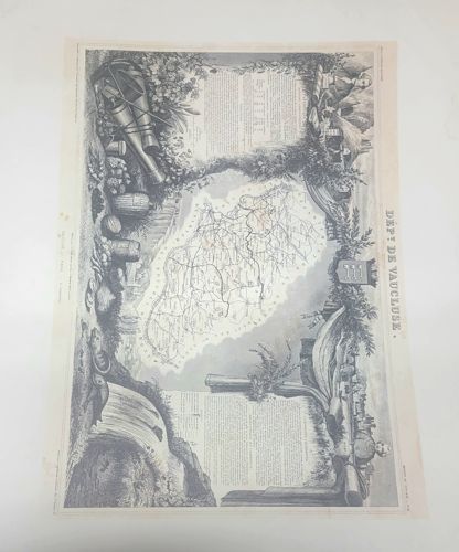
This item is an original steel engraving by the French cartographer Victor Levasseur, titled 'Dépt de Vaucluse,' originating from the mid-19th century (circa 1850). The piece is printed on cream-colored woven paper and features a central cartographic map of the Vaucluse department in France, showing road networks and topography. The map is surrounded by an extraordinarily intricate, decorative border—a hallmark of Levasseur's work—comprising allegorical figures, agricultural bounty (grapes, honeycombs, silks), regional weaponry, and a coat of arms. The engraving exhibits fine-line hatching and stippling techniques which provide significant depth and detail. Notable features include a portrait of a local figure in the upper right and a waterfall landscape in the lower left. Regarding condition, the paper shows light foxing concentrated on the left margin and moderate yellowing consistent with an age of approximately 170 years. The edges remain intact with a wide border, though slight undulation occurs across the surface. No major tears or repairs are visible. This piece serves as a prime example of the Romantic style of cartography, blending geographical accuracy with artistic embellishment typical of Levasseur's 'Atlas National Illustré.'