AI Item Analysis
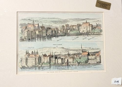
This item is an antiquarian hand-colored steel engraving or lithograph depicting two panoramic views titled 'The Strand from the Thames, Sixteenth Century'. The print showcases historical architectural landscapes of London along the riverfront, featuring prominent structures such as Somerset House and Durham House as they appeared in the 1500s. The artwork is composed of two horizontal registers; the top shows the skyline with hills in the background, and the bottom provides a closer view of the riverside palaces and churches. The color palette consists of soft, hand-applied watercolor tints in pale blue, terracotta, and olive green over black ink lines. It is professionally mounted within a cream-colored window mat. A significant marking is a gold foil sticker in the upper right corner stating 'THIS ANTIQUARIAN PRINT IS GUARANTEED TO BE OVER 100 YEARS OLD,' suggesting a Victorian-era production (mid-to-late 19th century) replicating 16th-century scenes. The condition shows minor age-toning and a light vertical crease or join in the center, typical for large-scale book plates. No visible foxing or water damage is present in the viewing window. The fine line-work and precise hand-coloring indicate high-quality craftsmanship intended for a historical or topographical publication.