AI Item Analysis
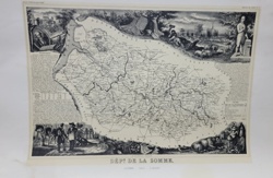
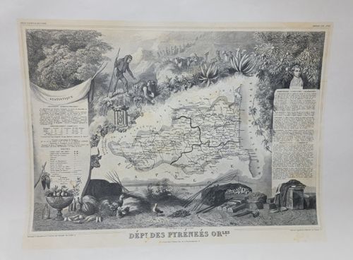
This is a monochrome steel engraving, likely a lithograph post-1845, representing the French department of Pyrénées-Orientales. Produced by Victor Levasseur for the 'Atlas National Illustré,' the map is framed by elaborate vignettes depicting the region's geography, industry, and culture. The composition features a central topographical map surrounded by allegorical and realistic scenes: a shepherd in traditional Basque or Catalan attire navigating rocky terrain, native flora like agave and heavy foliage, and local agricultural produce including poultry and vegetables. Text blocks on the left and right provide 'Statistique' (population, area, and administrative data) and historical summaries. Condition-wise, the cream-toned paper shows light foxing, minor creasing at the upper corners, and slight edge wear consistent with mid-19th-century prints. The engraving displays fine detail in cross-hatching and stippling, characteristic of the French cartography style during the reign of Louis-Philippe. It includes the distinctive 'Dép. des Pyrénées-Orles' title at the bottom, printed on heavy stock paper intended for an atlas binding.