AI identification & appraisal estimate

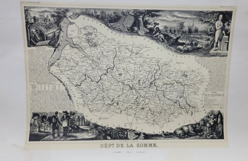
Victor Levasseur's 'Département de la Somme' Map from Atlas National Illustré

This name is the AI's identification of the item — it may be incorrect.

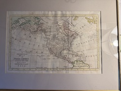
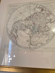
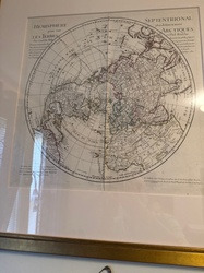
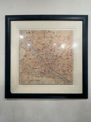
Submitted photo of Victor Levasseur's 'Département de la Somme' Map from Atlas National Illustré
Photo submitted by the user — not generated by AI

AI Estimated Value

Not an official valuation

$150 - $250

AI estimate as of March 14, 2026 · verify with a professional before acting

AI-Generated · Verify before acting

Everything on this page is generated by AI for informational purposes only. AI can make mistakes — the AI may misidentify items or misattribute them (artist, maker, brand, designer, origin, era). This is not an official valuation and should not be used for insurance, sale, tax, estate, legal, or lending purposes — or any decision requiring a certified appraisal. It is not an authoritative claim about any person, brand, or rights holder — do not share or rely on it as a factual statement about a third party. Always consult qualified professionals before making financial decisions.

Read the full disclaimer

AI Item Analysis

This is a mid-19th-century steel-engraved monochrome map of the Somme department in France, executed by the renowned cartographer Victor Levasseur. The map is printed on a rectangular cream-colored paper substrate. The central cartographic element displays the department's borders, river systems, and major towns. Surrounding the geography is an elaborate decorative border characteristic of Levasseur's 'Atlas National Illustré' style (circa 1845-1852). The vignettes depict regional industries, agriculture, and historical figures, including scenes of farming, livestock (cattle and sheep), and a portrait of a local dignitary in the upper left. Notable text includes 'DEP! DE LA SOMME' at the bottom and statistical data regarding population and administration on the left and right margins. The craftsmanship is high, showing fine line detail in both the topographical hatchings and the architectural backgrounds. Condition-wise, the print shows minor undulation across the paper surface, likely due to moisture or improper storage, and light foxing or oxidation consistent with its age of approximately 175 years. Faint vertical creases suggest it may have once been part of a bound volume. The margins appear clipped but intact enough for professional framing.

AI Appraisal Report

I have virtually examined this monochrome steel-engraved map of the 'Département de la Somme' by Victor Levasseur, originating from his celebrated 'Atlas National Illustré' (c. 1850). The piece exhibits the quintessential aesthetic of the period, characterized by neoclassical vignettes that blend geography with allegorical and industrial iconography. Based on visual evidence, the engraving displays the crisp line-work expected of an authentic mid-19th-century strike. Condition is a primary valuation factor. My examination reveals minor paper undulation, faint vertical fold lines consistent with historical atlas binding, and scattered foxing (oxidation spots). While these issues are typical for a 175-year-old document, the fact that this is a monochrome version rather than the more sought-after hand-colored edition slightly limits its ceiling. The margins appear somewhat tight but sufficient for conservation framing. The market for Levasseur maps remains stable due to their decorative appeal; however, they were produced in significant quantities, making this a 'common' rarity. Current demand favors specimens with vibrant contemporary or later coloring. Comparables for monochrome Somme plates sold in reputable galleries and auctions generally fall within the $150 to $250 range. Limitations: This appraisal is based solely on digital images. Without an in-person examination, I cannot verify paper weight, watermarks (e.g., 'Lettres' or 'Lecuyer'), or the presence of acidic residue from historical mounting. A physical inspection is required to confirm the absence of modern reproductive techniques or restoration. Verification of provenance or a 'Bureau de la Statistique' blind stamp would further solidify authenticity.

Keep exploring

More antique cartography and prints appraisals

Get your items appraised

Instant AI-powered appraisal estimates from a photo

Browse More Appraisals