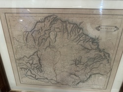
AI Item Analysis
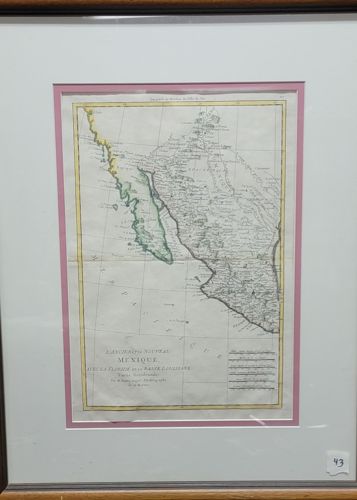
This is a hand-colored copperplate engraving of a map titled 'L'Ancien et le Nouveau Mexique,' prominently featuring the coastlines of California and the Gulf of Mexico. Created by the French royal cartographer Rigobert Bonne, likely dating from the late 18th century (circa 1780s). The map is printed on rectangular paper with a visible horizontal center fold, typical of maps originally bound in an atlas. It features hand-tinted borders in yellow and light green outlines along the coastline of Baja California and the mainland. The cartography includes French text, showing detailed topography, river systems, and settlements of the era. The item is professionally housed in a multi-layered framing system: a white outer mat, a thin pink inner accent mat, and a dark wood frame with a gold-tone inner lip. Regarding condition, the paper shows light toning and minor rippling, particularly along the lower edge and center fold. There are no major tears or visible foxing from this perspective, though a slight 'pinking' or oxidation of the pigments may have occurred over time. The craftsmanship reflects the high standard of 18th-century French scientific mapping, with fine line work and elegant typography.