Historical Map Appraisals
Discover recent historical map valuations and appraisals

Historical Map of the United States
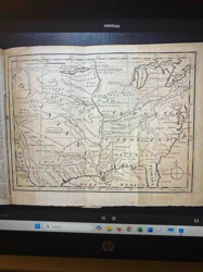
1763 Map of a Portion of North America from Gentlemen's Magazine

Antique World Map

Vintage Lake Minnetonka Map

Vintage World Map

Vintage China Map

Framed Map of Czechoslovakia (Stylized)
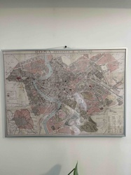
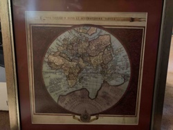
Framed 'ROMA PRESENTE E AVVENIRE' Map
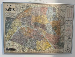
Framed Antique 'Plan de Paris' Map
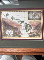
Framed 'Map of The Sandwich Isles' Decorative Print

Reproduction Antique World Map
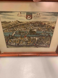
Historic Map/View of Paris (Lutetia) c. 1600
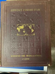
Hammond's Standard Atlas of the World
Framed Antique Style World Map Print
Framed Antique-Style World Map Print

Tower Defense Game Map
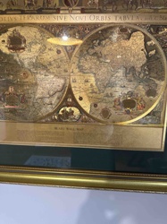
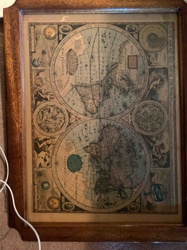
Framed Blaeu Wall Map Reproduction: Nova Totius Terrarum Orbis Tabula
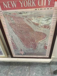
New York City Circa 1899 "How to Know New York City" Framed Map

Pike County, MS Property Map
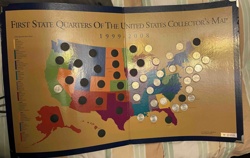
First State Quarters Of The United States Collector's Map (1999-2008)
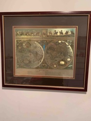
Framed Antique Style World Map Print 'Nova Totius Terrarum Orbis Tabula'

African Silhouettes with Map Framed Art

Abstract Urban Landscape Map Print

Rand McNally Reliable World Atlas

Framed Art Print of a Map-Textured Dove

The Explorer World Atlas by Rand McNally (Port of Portland Edition)
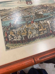
Framed 'Lutetia 1609' Cityscape Print (Paris)
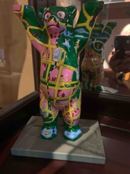
Buddy Bear Sculpture (Berlin Map Theme)
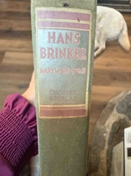
Hans Brinker by Mary Mapes Dodge (Grosset & Dunlap Edition)

Illuminated Globe
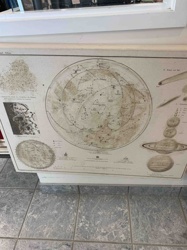
Vintage Astronomical Chart Canvas Print

Replogle World Nation 12" Globe on Stand
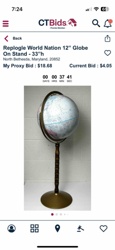
Replogle World Nation 12" Globe On Stand

Medieval Norwich
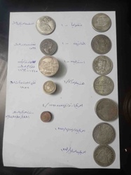
Assorted Historical Coin Collection with Annotations

Framed Historical Dual Portrait Print/Drawing

Portrait of a Man in Ornate Military/Ceremonial Uniform
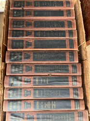
Historical Volume Collection
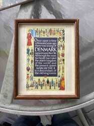
Framed Danish Monarchy Historical Print

Historical Commemorative Medal
Have Historical Map to Appraise?
Get instant AI-powered valuations for your historical map items
Get Your Historical Map AppraisedFree
Instant Appraisals
24/7
Available
AI
Powered Analysis