AI Item Analysis
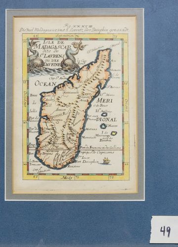
This is a hand-colored copperplate engraving of Madagascar by the French cartographer Alain Manesson-Mallet, originally published in his landmark work 'Description de l'Univers' circa 1683. The map features a vertical orientation of the island with a highly decorative title cartouche in the upper left corner, flanked by two mythical dolphins or sea monsters. It is framed by a graduated latitude and longitude border painted in a yellow wash. The topography is indicated by small pictorial mountain ranges and shaded coastlines common to late 17th-century cartography. The map is inscribed with French text for place names and German text in the top margin ('Die Insel Madagascar...'), indicating this specimen likely came from a German-market edition of Mallet's work. The paper shows an aged ivory patina consistent with late 17th-century rag paper. The hand-coloring is expertly applied, highlighting the borders and maritime elements in shades of yellow, ochre, and blue. Condition-wise, the print appears well-preserved with minor tonal variations and slight foxing on the margins, housed within a modern gray and gold-lined mat. The engraving displays fine detail in the line work, particularly in the topographical hatching and the intricate sea monster figures.