AI Item Analysis
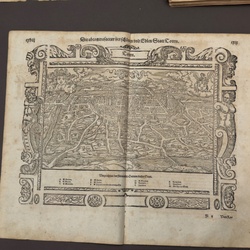
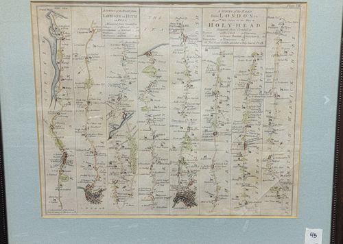
This is a hand-colored copperplate engraved strip map, likely from John Ogilby's influential 'Britannia' atlas, the first national road atlas of England and Wales, originally published in 1675. The map features seven vertical columns representing distinct segments of travel routes, specifically those from London to Hith (Hythe) and London to Holy-Head. The layout includes 'ribbon' maps that show the roads with topographical landmarks such as bridges, hills, woods, and local estates depicted in miniature. This specific plate is labeled 'Plate VII' in the upper right corner. The engraving is executed on laid paper and features delicate hand-tinting in green and yellow to highlight forested areas and town boundaries. The text includes mile markers and compass rose pointers for cardinal direction orientation. In terms of condition, the paper shows significant signs of age and historical handling; there is visible foxing throughout the margins, distinct vertical and horizontal creasing from original folding, and a notable v-shaped tear or heavy crease on the bottom right column. The piece is professionally matted with a blue-gray bevelled mat and appears to be housed in a dark wooden frame. The cartography style is typical of the late 17th to early 18th century, showcasing high-quality draftsmanship of the Restoration period.